30 Graded Walks Within 30 Miles Of Clackmannanshire
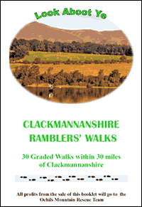 These walks are based on those done by the Clackmannanshire Ramblers. They were originally published in booklet format in 2006, with a second edition in 2009. All booklets have now been sold and it is not intended to print another edition. Instead the walks have been made freely available for download.
All proceeds from the sales of the booklets, a total of about £7,500, has been donated to the Ochil Mountain Rescue Team. Alhough these walks are now free to download and print, donations can still be made.
The costs of printing the original booklets were met by grants from Awards for All - Scotland, Visit Scotland, CFSLA Payroll Lottery Committee (Clackmannanshire, Falkirk & Stirling Local Authorities) and Clackmannanshire Community Chest (sponsored by Sterling Mills Outlet Shopping Village and Sterling Furniture). The Clackmannanshire Field Studies Society assisted in obtaining the Grants.
The walks
All the walks are on good tracks and are suitable for both summer and winter walking. However, except in the driest of summers, strong footwear is advisable as some of the paths can become muddy. The walks are circular, though it is possible to link some of them to give a linear walk.
The length of each walk is given in both miles and kilometres, but in the walk descriptions, kilometres are used. Note that at a steady 4 km/hour (2.5 mph) it will take 15 minutes to walk 1 kilometre. The walks are between about 5 and 15 kilometres (3 and 9 miles) with opportunities to lengthen or shorten some walks. Distances and ascents were calculated with Anquet Mapping software.
In general the walks are easy with no very steep sections. However, as this is a subjective assessment a general guideline is as follows:
- Grade 1 - ascent less than 300 ft
- Grade 2 - ascent between 300 ft and 800 ft
- Grade 3 - ascent between 800 ft and 1,200 ft
The map extracts are taken from the 1:50,000 Landranger Ordnance Survey (OS) maps, and the side of each square represents 1 kilometre (0.62 miles).
Care has been taken to ensure that the route guides are as accurate as possible, but the authors can take no responsibility for errors. Feedback on the walks is welcome, please email your comments and suggestions to the Countryside Rangers who will pass on your comments to Clackmannanshire Ramblers.
Viewing help
In order to view and print many of our documents and publications you may need additional software:
This document can be made available in other formats on request, for example larger print, braille, audio etc
- Files in PDF (Portable Document Format) require the free Adobe Acrobat Reader which can be downloaded from the Adobe website;
- Microsoft Word files can be viewed with the full version of Microsoft Word, or with the free Word Viewer which can be downloaded from the Microsoft website.
This document can be made available in other formats on request, for example larger print, braille, audio etc
Files for this document
 14 walks in Clackmannanshire (in PDF format) - Download 3764.pdf
11 walks in Stirling (in PDF format) - Download 3768.pdf
5 walks in Fife (in PDF format) - Download 3769.pdf